

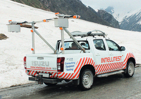
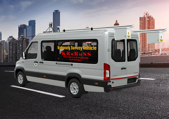
Network Survey Vehicle (NSV)
Automated Pavement Evaluation Survey System using Laser Crack Measurement System (LCMS)
Meet requirements of all applicable national and international standards for pavement evaluation and visual surface defects measurement. Data quality is better than manual, as the process is fully automated and computer driven and objective, with accurate results and better repeatability. NSV captures high-resolution pavement surface images using advanced cameras and imaging systems, enabling detailed analysis and documentation for maintenance planning and performance evaluation.
Network Survey Vehicle (NSV) is a special type of vehicle equipped with advanced technologies that scan and inspect the road surface condition and road performance parameters. It is great reliability, flexibility and ease of use for anyone who needs to collect road survey data accurately and quickly in automated mode. NSV can dramatically reduce labor costs and project completion time, and provide a visual record of surface conditions including, roughness (bumps), rutting, cracks, potholes, lane marking, and many other defects.
LCMS
The LCMS - 2 delivers standards-compliant and industry-proven results on more surfaces than any other sensor in the market. Pavemetrics Laser Crack Measurement System (LCMS - 2) is the ultimate single-pass 3D sensor for pavement inspection. It can automatically geo-tag, measure, detect and quantify all key functional parameters of pavement in a single pass.
Features
- Fully automated computer driven system
- All working based on 3D technology; x,y,z measurement
- Road Defect Rating calculations in automated mode
- Customized user defined template for defect reporting
- Readymade MS Excel File for RAMS / HDMI4 / NHAI format
- User defined distance (5m, 10m, ....) based data reporting
- GIS mapping and color coded map of surveyed area
- Display of pictures on GIS map along with road defects
- Inventory measurement and counting
- Accurate Right of Way measurement in tunnels, underpass & RoB etc.
- 360° Camera integrated GPU, CPU, GPS, IMU DMI
- Mobile Mapping integration for GIS mapping
- Automated stitched and compressed pictures from 5 m onwards
- Geotagged and Chainage stamping on all pictures
- Video making by stitching geotagged images
- Defect Detection and measurement without human interference
- Longitudinal Profile and Roughness for entire lane width
- IRI calculation for both wheel path as per ASTM E950
- Rutting measurement by 5 different methods in one lap
- Macro Texture measurement in MPD & MTD
- Bridge Approach and Expansion Joints measurement
- Merging of multi lanes data and pavement images
- Slope, Cross Fall and Super Elevation measurement
- GPS tagging of all defects and pavement Images
- Pavement Marking dimension measurement
- Sewer & Strom Drainage and Rumble Strip
- Pavement Type (Flexible / Rigid) Detection
- Automatic detection and measurement of length, width, depth (3D) and quantify for Sealed & Unsealed Cracks, Potholes, Rutting, Shoving, Raveling, Bleeding, Pick-out / Disintegration, Depression / Water Entrapment, Edge Dropoff and Curb.